HeliSAM refers to our airborne acquisition using a helicopter. HeliSAM is used commercially for large dipole (up to 12 km) SAM MMR / MMC surveys and for large scale SAM EM surveys.
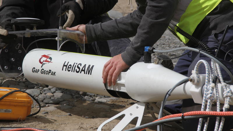
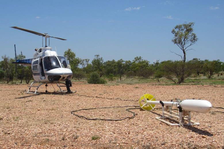
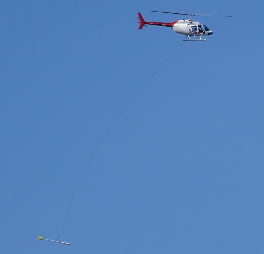
The HeliSAM system consists of the Cs sensor, GPS unit and laser altimeter mounted in a towed “bird” as shown in photo below. The bird is towed with a sling to mitigate interference from the helicopter. The sling length is typically 30m. No compensation is required for aircraft pitch, roll or yaw.
HeliSAM is used for large scale SAM MMR/MMC and FLEM surveys and typically uses Tx frequencies 3.125-15Hz. Achievable sample intervals are nominally 5.0m for TMI; 20m for MMR and TFEM (depending on Tx frequency).
Low frequency (LF) HeliSAM is a variant of HeliSAM where transmit frequencies as low as 2Hz are used. LF HeliSAM uses a 50m sling which enables the helicopter to fly at higher elevation above ground and at a slower speed.
HeliSAM achieves much greater production rates with typical survey speeds of 80 km/h. HeliSAM successfully detected the Lalor VMS deposit in Manitoba, Canada that lies between 700m – 1000m below surface.
Benefits
- Magnetic field measured up to 9600 readings/sec. (<5cm. sample interval)
- Increased data resolution due to helicopters ability to fly lower and slower than traditionally used fixed wing systems
- High accuracy positioning & navigation – suitable for DTM data
- Towed bird system – no aircraft effect on magnetic data (no real-time or post processed compensation required)
- Quick data transfer from the field back to head office – same day preliminary grids available
- Helicopters superior contouring capabilities – uniform data resolution
- Minimal ferry due to ability to base close to survey area Ideal for remote areas where no airstrips are available
- Digital video flight path available
- Aircraft equipped with satellite tracking for flight following
- Aircraft and support vehicle equipped with satellite phone and 2 way radio communications
- Experienced survey pilots and field crew
- Prompt system availability
Specifications
- DGPS positioning accuracy of 10cm horizontally and 15cm vertically
- Robinson R44 helicopter (turbine helicopter available on request)
- Sensor height 30m AGL (helicopter 60 m AGL) 2 diurnal base station magnetometers
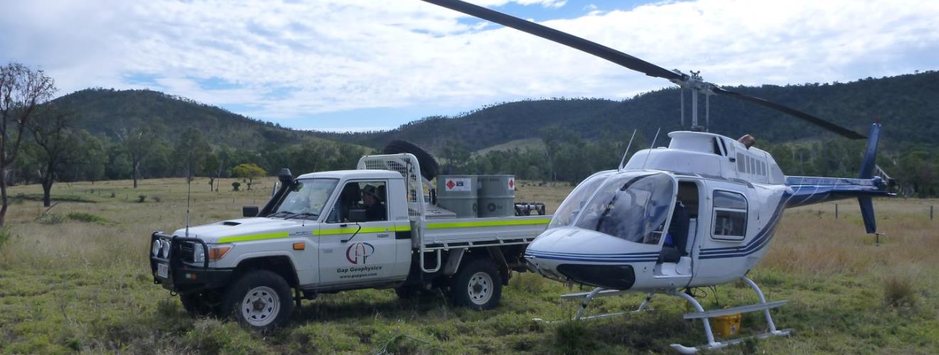
- Support ground crew and vehicle
- In-field data quality control